
Geospatial
Surveillance that goes far beyond what the naked eye can see!
Flyscan goes beyond leak and threat detection, taking monitoring to early warning and risk prevention.
Our trio of state-of-the-art photogrammetric cameras, featuring automated image processing, produces:
- orthomosaics (precise location);
- detailed topographic data sets (surface and terrain models);
- Coloured 3D point clouds.
All this information is analyzed and made available to you via our Geographic Information System (GIS), soon available online!
Surveillance that goes far beyond what the naked eye can see!
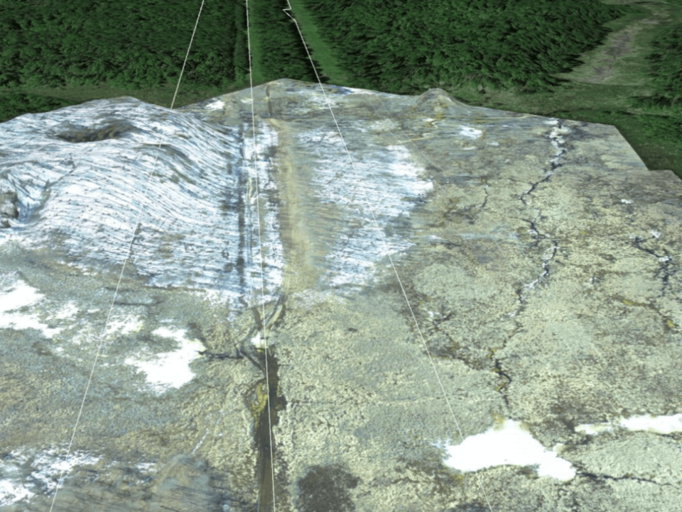
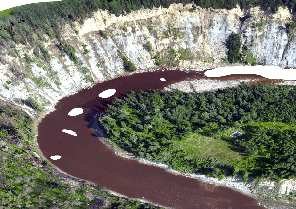
Terrain Dynamics and Ecosystem Insights
Our high-resolution topographic products (digital surface model or terrain) offer optimum accuracy and enable geohazard assessment along the easement or pipeline.
Advantages and benefits:
- Provide immediate risk indicators, such as a critical slope leading to a landslide.
- Detect topographical changes (displacements or changes in terrain).
- Reveal an evolving situation (slope creep).
Integrate these early warnings into the geography of your pipeline route!
Terrain Dynamics and Ecosystem Insights
GIS : Your decision-making partner
All geospatial layers are referenced for addition to Geographic Information Systems (GIS) so that they can form an integral part of your decision‑making processes.
A more detailed analysis, such as the risks associated with rivers, roads and level crossings (in compliance with regulations), can also be carried out.
GIS : Your decision-making partner